What Do You Do When Your Town Is Washing Away?
Dauphin Island, a thin barrier island located where the western edge of
Mobile Bay empties into the Gulf of Mexico, holds many histories. It was
the site of a Pre-Columbian Mississippian settlement. It was the place
of arrival for the first slave ships sent to French colonial Louisiana
in 1719. It was where the Union Navy finally sealed their war blockade
of the eastern Gulf in 1864. But the weight of human history does not
guarantee a place physical permanence or stability.
Current-day
Dauphin Island is among the most storm-threatened inhabited barrier
islands in the United States. The town, with less than 1,800 permanent
residents, is smaller and more geographically isolated than the vast
majority of Gulf Coast beach towns but relies on tourist income. Without
enough money or population to sustain a high school, local teens have
to travel 27 miles each day to Bayou La Batre for school.
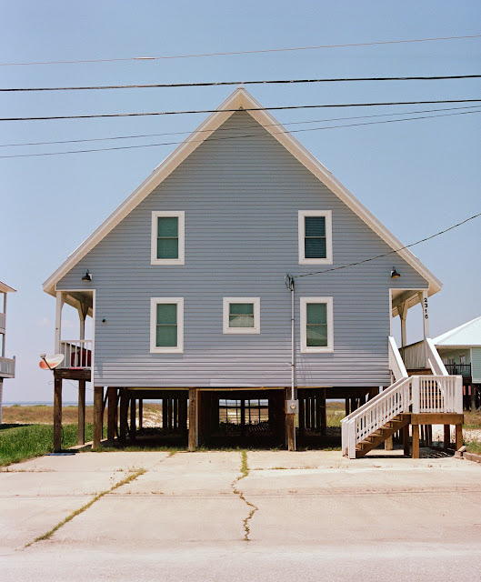
The municipal revenue that beachgoers provide is often sunk back into basic land stabilization, a topic of great local political contention. Tourist income primarily comes from stilted vacation rentals on the western portion of the island, a frighteningly skinny strip of sand and scrub that has been repeatedly devastated by hurricanes. The fourth photo in this set is a National Weather Service image of the aftermath of Katrina, which fully covered the western part of Dauphin Island in water and actually ripped the island in half, leaving a mile-and-a-half long gap of ocean that wasn't filled until state money appeared from the BP oil spill settlement years later. The wider eastern half of the island is home to most of the area's permanent residents, but it tends to be lower priority for earthworks projects despite being where storm damage is more likely to harm somebody's home, rather than somebody's investment.
Scholars of climate change, barrier island ecosystems, and disaster relief finance increasingly consider places like Dauphin Island to be unsustainable. Every big storm introduces new complications, takes away more shoreline, and requires expensive fixes that often fail when the next big storm comes. It is possible that Dauphin Island may one day wash away completely.
The big Alabama news org AL.com also has years of reporting worth reading on the "Katrina Cut", the 8,000 foot gash in Dauphin Island that was filled in the early to mid 2010s via a controversial earthworks project. The portion of Dauphin Island that was disconnected by Katrina was entirely uninhabited - the sole road through most of the island's western portion cuts out before reaching a long stretch of undeveloped shoreline - but reconnecting it was deemed a priority because the damaged beachfront on the island's western half was a large draw for visitors.

.jpg)

